This spring has started out very much like the last; cool and rainy. At a time when the kayaks should already be in the water, mid-April brought us one of the strongest April Nor'easters to hit the New England Coast in a very long time. Saturday, May 12th was my first paddle of any distance, most years I usually have a chance to paddle a few shorter trips to get my muscles more or less accustomed to exercise again. For the most part, it was a perfect day for a paddle. At this time of year, I am wearing a dry suit along with a neoprene base layer, so cooler temperatures make for best paddling.
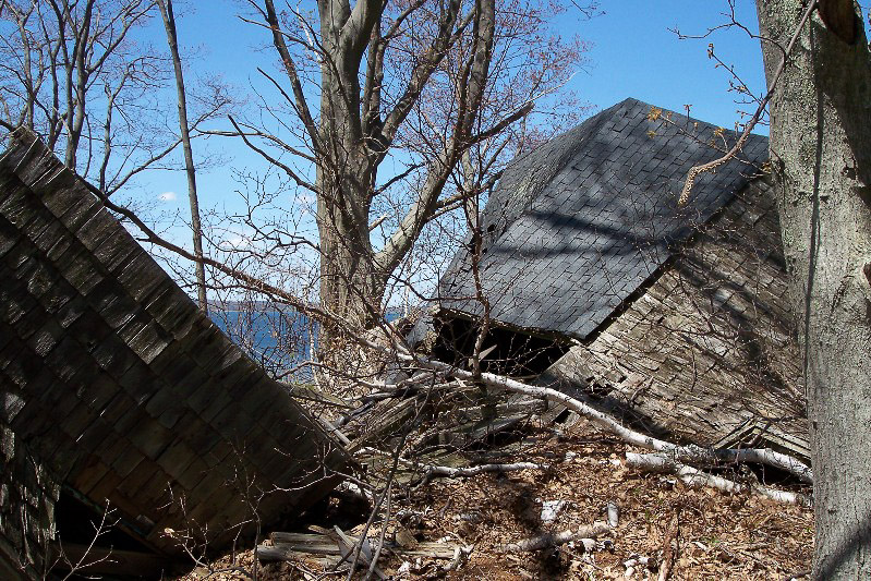
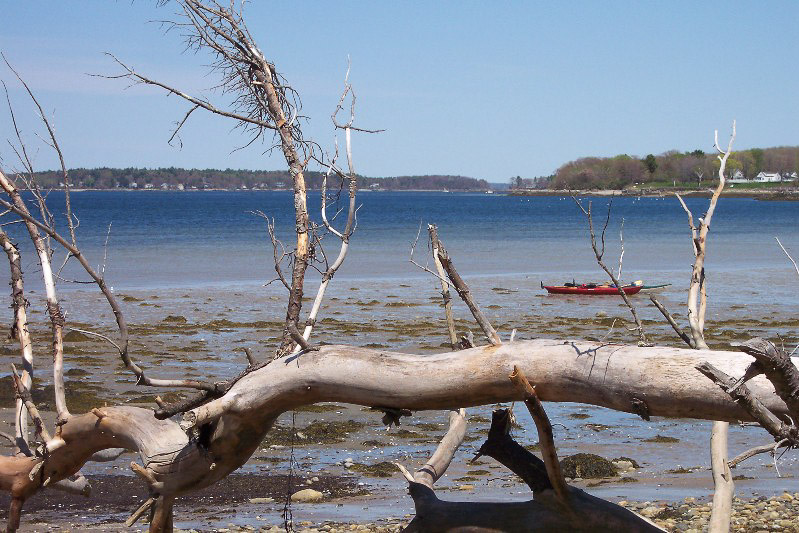
My friend and I launched from Cousins Island at around 10 am or so; we just planned on a light day of paddling to give a chance to explore a couple of Islands along the way. We headed south along Cousins Island, then turning towards the southeast after passing the power plant. The day started off a little on the cool side, but quickly warmed up as the sun made its way higher in the sky. The water is still very cool at time of year, so a dry suit is a mandatory part of ones paddling wardrobe. We decide to chart our course between Chebeague and little Chebeague Island's to make our way towards an old shipwreck that is located in Chivericks Cove along the northeastern shore of Long Island. During high tide the wreck is only partially visible, but during low tide, many of the ship's ribs rise out of the water some 10 to 12 feet. We stopped on the sand bar that connects Chebeague and Little Chebeague Islands during low tide and then decided to head farther down to get out and explore the island some more. Little Chebeague Island is open to the public and is also part of the Maine Island trail. During the late 1800's the island was home to a hotel and resort community. Thanks to Dick Innes, a local historian, the public can walk the trail and sign system that he has created on the Island. The remains of these building still exist, although they are unsafe to enter. A Steel building on the southeast side of the Island was used by the military during the Second World War.
After finding a suitable place to land the kayaks, my friend and I took some time to hike the trails that wind their way through this little island. The weather has taken a toll on many of the signs, but most are still readable and included photos of what the cottages once looked like before they succumbed to the weather. After spending some time hiking around the island and eating a small lunch, we headed southwest for a little way a then turned westward towards Clapboard Island. We then made our way back to Cousins Island along a northeast track that took us along the eastern side of Clapboard and Sturdivant Islands. As we approached the Sandy Point Ledges, which are located between Cousins Island and the mainland, we were followed by a couple of harbor seals that call Casco Bay home. The route took us through 13 miles of Casco's waters, which is not a long paddle by any means. It was great to just spend a full day out on the water and taking the time to hike one of the many islands that can be found in Casco Bay. Please keep in mind that not all islands in the bay are open to the public. Plan your trip ahead of time and research which islands are open to the public. Remember that when you do make a stop on a public island to stay on the designated trails, do not build fires and to "leave no trace".