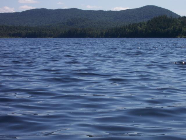
The Connecticut lakes Region, located in the northern tip of New Hampshire, covers 300,000 acres. This area has become one of my favorite "long weekend" getaway destinations. This wilderness area of New Hampshire offers a huge variety of activities for the outdoor enthusiast with 4 lakes to paddle on and plenty of hiking trails to explore. These are the head waters of the Connecticut River, which flows south to the Atlantic Ocean over 400 miles away. The vast majority of the land north of Pittsburg is owned by the logging companies, however they have opened this land for public use. Camping is restricted to the two state owned campgrounds and a few privately owned campgrounds. The town of Pittsburg was established in 1832 as an independent nation during the border dispute between the US and Canada. The lakes, located north of Pittsburg, are easily accessible from route 3 in an area that has become known as "Moose Alley". A drive on route 3 around dawn or dusk will explain why; this is the best place in New Hampshire for moose viewing.

Lake Francis, the second largest lake in the region, covers 2,082 acres and will be the first lake you will encounter upon your arrival to the area. Built in 1940 for flood control, it has become a popular spot for fisherman. Although it is one of the heaviest used lakes in the chain, the boat traffic can be described as light even during the height of the summer tourist season. There are a number of houses located along its shores, but you will still get the feeling of being in the wilderness because of the surrounding landscape. The next lake in the chain is the First Connecticut lake and at 2,807 acres is the largest of the four. Like Lake Francis, it is a very popular location but has fewer homes along it's shore. This is a must paddle lake if you are planning on being in the area. The boat traffic on this lake is similar to that of Lake Francis. The Second Lake covers about half as much area as the first; 1,286 acres. Boat traffic is far less then the first two on the list and it is virtually free of any development. At just 289 acres in size, the Third Lake is the last in the chain that is navigable. There is very little boat traffic on this lake and will take only about an hour to paddle all the way around it. This lake is ideal for a quiet early morning or late day paddle. Another "must paddle" body of water is the East Inlet, which is located just north of the Second Lake. The main body of water is a mere 43 acres, however you can travel some distance up the river that feeds the inlet. The passage way will narrow as you progress and can at times be challenging for those with larger touring kayaks. This is a great area to see moose, especially in the evenings,. This small side trip is well worth the time. For a map of the East Inlet, please click on the link below. The Fourth Connecticut Lake is really not much more then a very small pond which is located on the U.S./Canadian border. The Fourth Lake is the very beginning of the Connecticut River and is accessible only by foot.. The trailhead is located on the west side of the US customs station on route 3 and parking is located across the road from the station. The trail follows the border and will take you about 45 minutes to reach the pond.

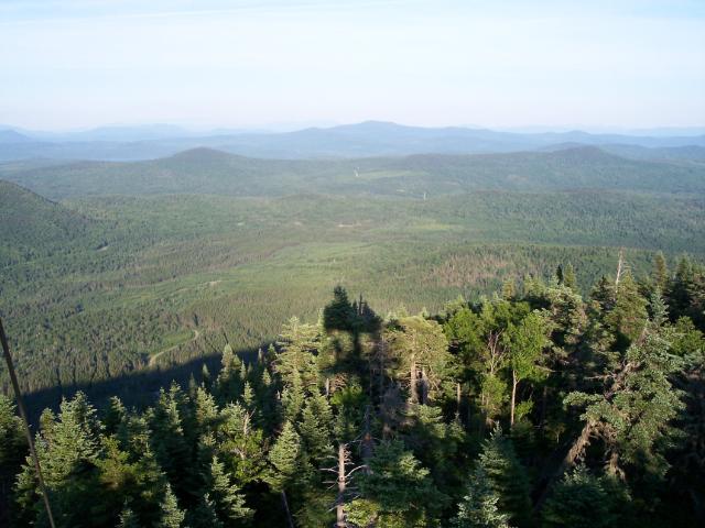
If you are looking to stretch you legs and go for a hike, there are plenty of trails in area to do just that. Some of the other natural features in the area include Garfield Falls, The Canyon at Indian Stream Falls and the Magalloway Mountain Fire Tower. The picture on the right was taken from the top of the fire tower during the summer of '05; the view was absolutely awesome. It is a little bit off the beaten path, but from the top of the tower you can see into Maine, Vermont and Quebec.
This area of New Hampshire offers a chance to folks to experience a true wilderness experience, even during the states busiest time of the year. For reservations at Deer Mountain Camp Ground or lake Francis State Park you can contact Reserve America at 1-877-nhparks (1-877-647-2757) or visit: nhstateparks.org